
New book about maps and their influence on war and peace. Amazon has the book, National Geographic has the story. The first map is from the book, the other three are from Wikipedia. The first three show the Boston peninsula where the battle was fought. The last one shows a larger area. Click to embiggenate. Via Posthip Scott.
 |
|
1775 map of the Battle of Bunker Hill showing positions of (left to right) an Arm'd Transport, a floating battery, Gla(f)sgow, another floating battery, an unnamed ship and the Faulcon Drawn during the battle by British Lieutenant Thomas Hyde Page Image courtesy of Buyenlarge, Getty Images |
 |
|
1875 Map of battle ground on Charlestown peninsula, encompassing Bunker and Breed's Hills, showing positions of a couple of gondolas, Somerset, Lively & Falcon George E Ellis, History of the Battle of Bunker's Hill |
 |
|
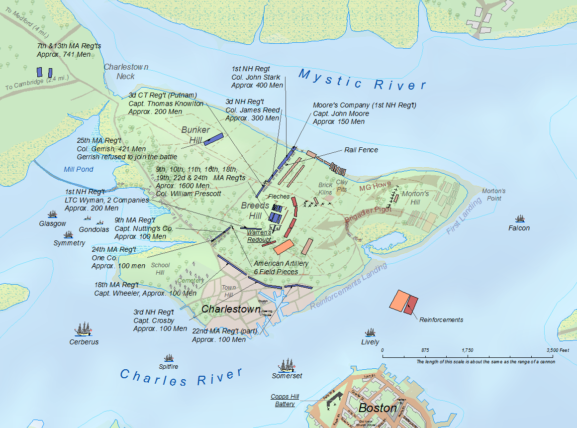
2011 Map showing the positions of the American forces at the outset of the Battle of Breeds Hill. showing positions of Glasgow, Symmetry, Cerebus, Spitfire, Somerset, Lively & Falcon Charlies E. Frye |
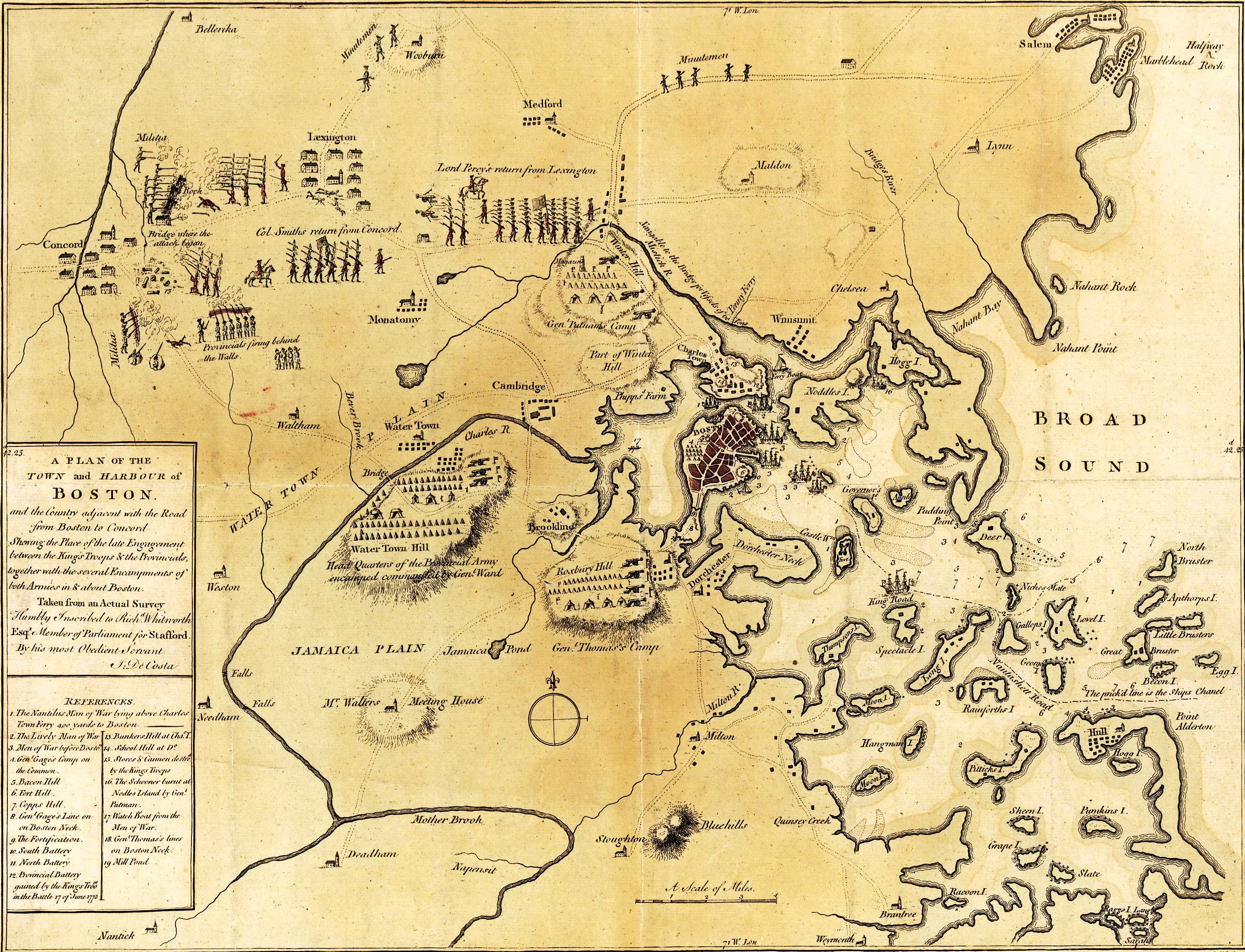 |
| 1775 Map depicting the 1775 Battles of Lexington and Concord and the Siege of Boston
J. DeCosta |


No comments:
Post a Comment